Platja de Calabecs
4.2★ · 33 Google ratings, Catalonia
✓ Short walk✓ Restrooms
At a glance
Parking
Not mapped
Walk
10 m · under a minute
Restrooms
Yes · 550 m away
Length
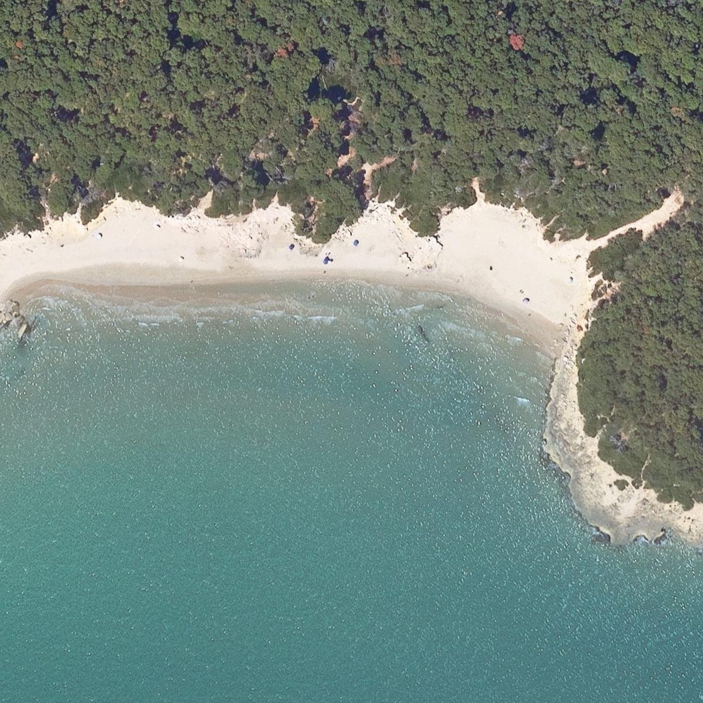
200 m of shoreline
Sand
40 m from the water to the back
Map of Platja de Calabecs
Guide
Good to know
Good for snorkeling and waves
The water has bigger waves than larger nearby beaches, and visitors report it works well for snorkeling.
Visit on weekday mornings for quiet
A visitor who arrived Wednesday in July found it uncrowded, while weekends and warm days draw significantly more people.
Arrive early to secure space
The small cove fills quickly on warm days, with some visitors finding no room to stay if they arrive late.
Expect a 15-minute forest walk
Access requires walking a dirt path through woodland, which one visitor found not worth the effort for the beach itself.
Nudist beach with mixed enforcement
The beach designates naturist and clothed zones, but reviewers increasingly report clothed swimmers in naturist areas causing discomfort.
Conditions
How it is right now
Air
26.5°C · mostly clear
Wind
2 km/h from the WNW
Shelter
Cross-shore · wind running along the beach
UV index
7 peak today
Last updated Sep 3, 10:34 PM.
Practical
Plan your visit
📍 43007, Tarragona
🌊 Water 10 m away, under a minute walk
🚽 Restrooms 550 m away
Nearby
Other beaches close by
50 m away
650 m away
650 m away
700 m away
800 m away
1.9 km away
Find another
Not the right one?
Find another beach that works for today.
Where are you starting from?
More options
What matters today?
Contribute
Been here recently?
Help other visitors with fresh information about Platja de Calabecs. Everything below is optional except the last box.
Questions
Common questions
How far is the walk to the water at Platja de Calabecs?
10 m in a straight line from the listing to the mapped shoreline, under a minute. Soft sand and dune make the real walk longer than the straight line.
Does Platja de Calabecs have restrooms?
Restrooms are mapped 550 m from the listing.
Measured from OpenStreetMap, public aerial imagery and live conditions data, and counted from visitor reviews. Every source, in full.
