Right Beaches › Michigan › Portage
Ramona Park Beach
4.0★ · 50 Google ratings · Portage, Michigan
✓ Parking✓ Short walk✓ Restrooms
At a glance
Parking
On-site lot · 330 ft away · paid
Walk
330 ft · 1 min
Restrooms
Yes
Cost
Paid parking
Sand
160 ft from the water to the back
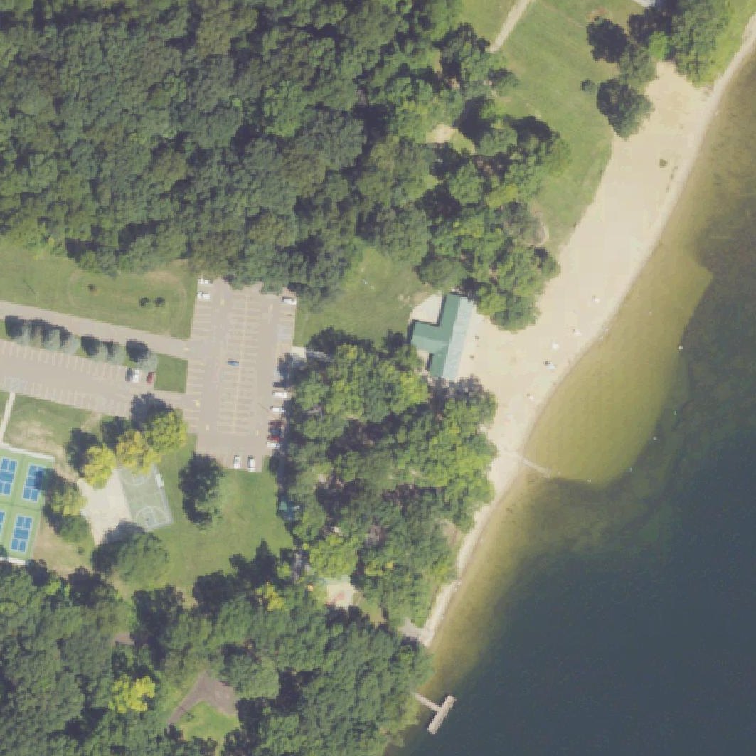
Map of Ramona Park Beach
1
1Parking330 ft from the listing
Guide
Good to know
Anyone may park, for a fee
Reviewers report paid parking open to anyone.Reported by visitors
Best for young children
The shallow, warm water and small swim area work well for toddlers and preschoolers to splash and play.
Arrive on weekday mornings
Weekends get crowded enough that swimmers stand shoulder to shoulder in the small designated swim area.
Know the strict rules upfront
No floaties, no beach balls, no frisbees in water, and lifeguards actively enforce these limits.
Bring water shoes
The sand gets extremely hot underfoot on sunny days according to visitors.
Conditions
How it is right now
Air
68°F · clear
Wind
4 mph from the ESE
UV index
6 peak today
Last updated Sep 4, 8:14 AM.
Practical
Plan your visit
📍 Portage, MI 49002
🅿 Parking 330 ft from the listing
🌊 The listing sits on the shoreline
Contribute
Been here recently?
Help other visitors with fresh information about Ramona Park Beach. Everything below is optional except the last box.
Questions
Common questions
Where do you park at Ramona Park Beach?
The nearest mapped parking area is 330 ft from the listed location. Positions come from OpenStreetMap, not from review text.
How far is the walk to the water at Ramona Park Beach?
The listed location sits on the shoreline itself, so there is no walk to speak of once you are out of the car.
Does Ramona Park Beach have restrooms?
No restrooms are mapped within 600 m on OpenStreetMap. That means nobody has mapped any, which is not the same as there being none.
Measured from OpenStreetMap, public aerial imagery and live conditions data, and counted from visitor reviews. Every source, in full.
