Right Beaches › Cape Cod › Edgartown
North Neck Shore Access
4.7★ · 19 Google ratings · Edgartown, Massachusetts
✓ Short walk
At a glance
Parking
Not mapped
Access
6:30am to 8:30pm
Walk
1.1 miles · 23 min
Water
69°F · modelled, no buoy nearby
Tide
2 ft range today
Length
1.2 miles of shoreline
Sand
180 ft from the water to the back
Crowds
Quietest Wed 8am
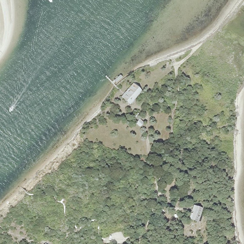
Map of North Neck Shore Access
Guide
Good to know
Dogs
Dogs under immediate control year round mvlandbank.com, 2026/09
Explore multiple parking areas
Four distinct parking areas provide access, so check a few spots to find the activity level you prefer.
Plan to enjoy views from above
The steep stairs down to the water mean you can appreciate the bay views from the top before.
Navigate past the unmarked dirt road
The access point lacks signage and sits down an inconspicuous dirt road, so GPS alone may not feel convincing.
Wear water shoes for wading
Limited dry beach means most of the shoreline is wet, so footwear designed for water is practical.
Conditions
How it is right now
Air
69°F · overcast
Water
69°F · modelled, no buoy nearby
Waves
3.0 ft · 6 s apart
Wind
3 mph from the WSW
Shelter
Onshore · wind blowing straight in off the water
UV index
6 peak today
| Time | Tide | Height |
|---|---|---|
| 06:20 | High tide | ↑ |
| 11:35 | Low tide | ↓ |
| 18:21 | High tide | ↑ |
Last updated Sep 4, 3:46 AM.
Crowds
When it gets busy
| 8a | 9a | 10a | 11a | 12p | 1p | 2p | 3p | 4p | 5p | 6p | 7p | |
|---|---|---|---|---|---|---|---|---|---|---|---|---|
| Mo | ||||||||||||
| Tu | ||||||||||||
| We | ||||||||||||
| Th | ||||||||||||
| Fr | ||||||||||||
| Sa | ||||||||||||
| Su |
QuietBusy
Practical
Plan your visit
📍 5 N Neck Rd, Edgartown, MA 02539
🌊 Water 1.1 miles away, about 23 min walk
Nearby
Other beaches close by
1.8 miles away
1.8 miles away
2.0 miles away
3.6 miles away · shorter walk
3.6 miles away · shorter walk
4.0 miles away · shorter walk
Find another
Not the right one?
Find another beach that works for today.
Where are you starting from?
More options
What matters today?
Contribute
Been here recently?
Help other visitors with fresh information about North Neck Shore Access. Everything below is optional except the last box.
Questions
Common questions
How far is the walk to the water at North Neck Shore Access?
270 ft in a straight line from the listing to the mapped shoreline, about 1 min. Soft sand and dune make the real walk longer than the straight line.
Does North Neck Shore Access have restrooms?
No restrooms are mapped within 600 m on OpenStreetMap. That means nobody has mapped any, which is not the same as there being none.
When is North Neck Shore Access least busy?
Google visit patterns put the quietest hour at Wed 8am and the busiest at Wed 5pm.
Measured from OpenStreetMap, public aerial imagery and live conditions data, and counted from visitor reviews. Every source, in full.
